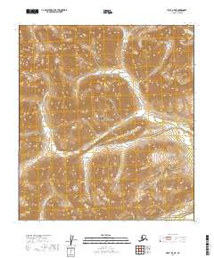
2019 Map of Healy B-5 NE
USGS Topo · Published 2019About this map
Denali National Park encompasses the majority of this high-elevation Alaskan terrain, where glacial drainages carve deeply through the landscape. The hydrography is defined by the headwaters of Windy Creek, which branches into the W Fork Windy Creek and the West Fork Windy Creek as they flow through steep-walled valleys. This map highlights the complex drainage patterns typical of the interior ranges, leading toward the prominent geographic saddle of Foggy Pass. The absence of roads or permanent structures underscores the wilderness character of this region during the 2019 survey. Researchers can trace the intricate contour intervals that define the ridges separating Little Windy Creek from the primary Windy Creek system.
Find a feature on this map
12 named features on this map. Tap any name to fly to it.
Don’t see what you’re looking for? This feature index may not catch every label — zoom into the map to look around manually.
Map Details
Editions of this 2019 Healy B-5 NE Map
This is the sole edition of this map. No revisions or reprints were ever made.
Other maps of this area

1949 · Healy B-4
USGS Topo · 1:63,360

1950 · Healy C-4
USGS Topo · 1:63,360

1950 · Healy B-5
USGS Topo · 1:63,360

1951 · Healy
USGS Topo · 1:250,000

1951 · Healy B-5
USGS Topo · 1:63,360

1951 · Healy B-4
USGS Topo · 1:63,360

1952 · Healy C-5
USGS Topo · 1:63,360
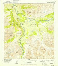
1952 · Healy C-4
USGS Topo · 1:63,360

1953 · Healy C-5
USGS Topo · 1:63,360

1953 · Healy B-5
USGS Topo · 1:63,360