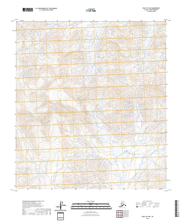
2024 Map of Healy B-5 NW
USGS Topo · Published 2024About this map
Denali Wildernness encompasses much of this interior landscape, where the high-altitude terrain of the Alaska Range gives way to deep glacial carved valleys. The northern portion of the sheet is dominated by Refuge Valley, a significant topographical depression situated between towering peaks that define the regional drainage patterns. In the southern half of the quadrangle, the headwaters and upper reaches of Cantwell Creek flow through the township boundaries of T17S and T18S. This 2024 survey documents the wilderness area as it remains today, showing a landscape defined entirely by natural contours and water systems, devoid of modern roads or permanent settlements within these specific township ranges.
Find a feature on this map
10 named features on this map. Tap any name to fly to it.
Don’t see what you’re looking for? This feature index may not catch every label — zoom into the map to look around manually.
Map Details
Editions of this 2024 Healy B-5 NW Map
This is the sole edition of this map. No revisions or reprints were ever made.
Other maps of this area

1950 · Healy B-5
USGS Topo · 1:63,360

1951 · Healy
USGS Topo · 1:250,000

1951 · Healy B-5
USGS Topo · 1:63,360

1952 · Healy C-5
USGS Topo · 1:63,360

1953 · Healy C-5
USGS Topo · 1:63,360

1953 · Healy B-5
USGS Topo · 1:63,360

1954 · Healy C-6
USGS Topo · 1:63,360

1954 · Healy B-6
USGS Topo · 1:63,360
1956 · Healy B-5
USGS Topo · 1:63,360

1956 · Healy
USGS Topo · 1:250,000