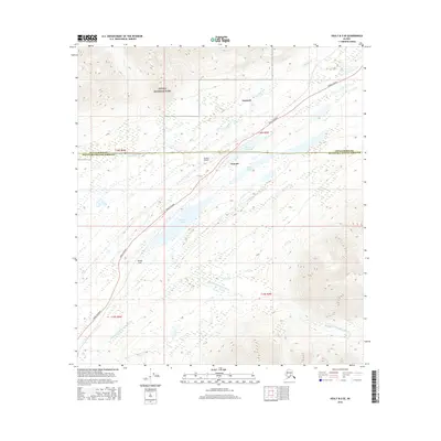
2016 Map of Healy B-5 SE
USGS Topo · Published 2016About this map
Broad Pass serves as a critical corridor through the Alaska Range, anchoring the geography of this survey. The Parks Highway serves as the primary artery, paralleling a series of significant alpine water bodies including Summit Lake, Mirror Lake, and Edes Lake. Near the northern boundary, the settlement of Cantwell sits just outside the expanse of Denali National Park, marking a transition point between the protected wilderness and the transit routes heading south. The southern portion of the map is defined by the drainage of the Middle Fork Chulitna River, while the high-altitude settlement of Summit is supported by the Summit Airport, highlighting the importance of aviation in this interior Alaskan landscape. This area represents a vital drainage divide, where Cantwell Creek flows toward the north and the Coal Cr system begins its descent toward the southern coast.
Find a feature on this map
18 named features on this map. Tap any name to fly to it.
Don’t see what you’re looking for? This feature index may not catch every label — zoom into the map to look around manually.
Map Details
Editions of this 2016 Healy B-5 SE Map
This is the sole edition of this map. No revisions or reprints were ever made.
Other maps of this area

1949 · Healy B-4
USGS Topo · 1:63,360

1950 · Healy A-4
USGS Topo · 1:63,360

1950 · Healy A-5
USGS Topo · 1:63,360

1950 · Healy B-5
USGS Topo · 1:63,360

1951 · Healy
USGS Topo · 1:250,000

1951 · Healy B-5
USGS Topo · 1:63,360

1951 · Healy B-4
USGS Topo · 1:63,360

1952 · Healy A-4
USGS Topo · 1:63,360

1952 · Healy A-5
USGS Topo · 1:63,360

1953 · Healy B-5
USGS Topo · 1:63,360