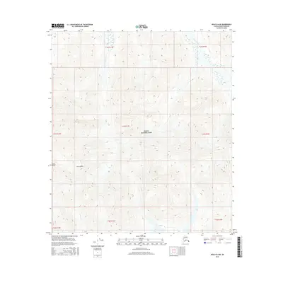
2016 Map of Healy B-6 NE
USGS Topo · Published 2016About this map
Denali National Park encompasses the high-altitude terrain of this interior Alaska wilderness, dominated by the massive profile of Mt Pendleton. The landscape is a study in glaciated geography within the Alaska Range, where steep contour intervals reveal the severe verticality of the peaks. Drainage patterns are clearly defined by the Teklanika River in the northeast and the East Fork Toklat River cutting through the northern reaches. To the south, the Bull River emerges from the glacial slopes, illustrating the complex hydrology of the subarctic. This 2016 survey provides a precise record of the physical features and township boundaries, including t17s r11w, during a period of modern glacial monitoring and conservation management.
Find a feature on this map
14 named features on this map. Tap any name to fly to it.
Don’t see what you’re looking for? This feature index may not catch every label — zoom into the map to look around manually.
Map Details
Editions of this 2016 Healy B-6 NE Map
This is the sole edition of this map. No revisions or reprints were ever made.
Other maps of this area

1950 · Healy B-5
USGS Topo · 1:63,360

1951 · Healy
USGS Topo · 1:250,000

1951 · Healy B-5
USGS Topo · 1:63,360

1952 · Healy C-5
USGS Topo · 1:63,360

1953 · Healy C-5
USGS Topo · 1:63,360

1953 · Healy B-5
USGS Topo · 1:63,360

1954 · Healy C-6
USGS Topo · 1:63,360

1954 · Healy B-6
USGS Topo · 1:63,360
1956 · Healy B-5
USGS Topo · 1:63,360

1956 · Healy
USGS Topo · 1:250,000