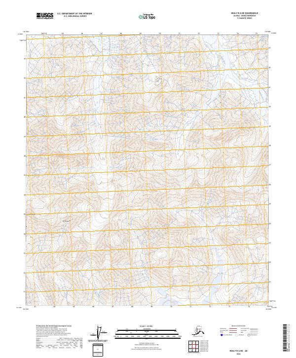
2024 Map of Healy B-6 NE
USGS Topo · Published 2024About this map
Denali Wilderness occupies the central portion of this survey, protecting a high-altitude landscape within the Alaska Range. The topography is dominated by the steep slopes of Mt Pendleton, where glacial drainage feeds into two major glacial river systems. To the west, the headwaters of the Bull River cut through deep mountain valleys, while the eastern edge of the quadrangle is defined by the braids of the Toklat River. This 2024 USGS map illustrates the complex drainage patterns of these glacial rivers before they exit the mountains into the lower tundra. The map relies on imagery from 2010 to document the shifting riverbeds and snow fields, offering a modern record of one of the most protected wilderness environments in the United States.
Find a feature on this map
12 named features on this map. Tap any name to fly to it.
Don’t see what you’re looking for? This feature index may not catch every label — zoom into the map to look around manually.
Map Details
Editions of this 2024 Healy B-6 NE Map
This is the sole edition of this map. No revisions or reprints were ever made.
Other maps of this area

1950 · Healy B-5
USGS Topo · 1:63,360

1951 · Healy
USGS Topo · 1:250,000

1951 · Healy B-5
USGS Topo · 1:63,360

1952 · Healy C-5
USGS Topo · 1:63,360

1953 · Healy C-5
USGS Topo · 1:63,360

1953 · Healy B-5
USGS Topo · 1:63,360

1954 · Healy C-6
USGS Topo · 1:63,360

1954 · Healy B-6
USGS Topo · 1:63,360
1956 · Healy B-5
USGS Topo · 1:63,360

1956 · Healy
USGS Topo · 1:250,000