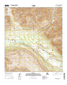
2016 Map of Healy C-3 NW
USGS Topo · Published 2016About this map
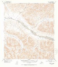
Healy rises as a prominent landform within this 2016 survey, a remote section of the Alaska Range where high-altitude contours define a landscape shaped by glacial activity and river erosion. The hydrology of the area is dominated by the Yanert Fork, a major glacial river system flowing through the southern half of the quadrangle. This braided river channel, characterized by its wide gravel beds and shifting currents, contrasts with the more confined drainage of Dean Cr in the northeast. The map represents a modern look at this Alaskan interior before more recent shifts in glacial melt, capturing the precise topography of the subarctic terrain and the distinct boundaries of the public land survey system, including t13s r4w and t14s r5w.
Find a feature on this map
9 named features on this map. Tap any name to fly to it.
Don’t see what you’re looking for? This feature index may not catch every label — zoom into the map to look around manually.
Map Details
Editions of this 2016 Healy C-3 NW Map
This is the sole edition of this map. No revisions or reprints were ever made.
Other maps of this area

1949 · Healy C-3
USGS Topo · 1:63,360

1950 · Healy D-4
USGS Topo · 1:63,360

1950 · Healy C-4
USGS Topo · 1:63,360

1950 · Healy D-3
USGS Topo · 1:63,360

1951 · Healy
USGS Topo · 1:250,000
1952 · Healy D-3
USGS Topo · 1:63,360
1952 · Healy C-4
USGS Topo · 1:63,360
1952 · Healy D-4
USGS Topo · 1:63,360
1952 · Healy C-3
USGS Topo · 1:63,360

1956 · Healy
USGS Topo · 1:250,000