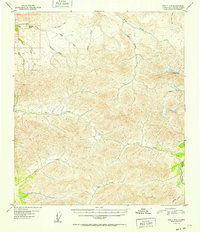
1952 Map of Healy D-3
USGS Topo · Published 1952About this map
Totatlanika River and the Wood River define the western and eastern boundaries of this mid-century topographic study in the Alaska interior. The landscape is dominated by a complex network of alpine drainage systems, with the waters of Healy Creek and Cody Creek carving through the high country. Isolated evidence of human activity is sparse, marked only by occasional cabins located near the riverbanks. The nomenclature of the smaller tributaries, such as All Gold Creek, Gold King Creek, and Last Chance Creek, suggests a history of prospecting and mining exploration in the foothills. High points like Keevy Peak and Needle Rock provide significant navigational landmarks in a region largely defined by its intricate system of ridges and valleys. This map, based on 1949 aerial photography, documents the area before significant modern infrastructure reached these remote drainage basins.
Find a feature on this map
20 named features on this map. Tap any name to fly to it.
Don’t see what you’re looking for? This feature index may not catch every label — zoom into the map to look around manually.
Map Details
Editions of this 1952 Healy D-3 Map
2 editions found
Other maps of this area

1949 · Healy C-3
USGS Topo · 1:63,360

1949 · Fairbanks A-2
USGS Topo · 1:63,360

1950 · Fairbanks
USGS Topo · 1:250,000

1950 · Healy D-4
USGS Topo · 1:63,360

1950 · Healy C-4
USGS Topo · 1:63,360

1950 · Fairbanks A-4
USGS Topo · 1:63,360

1950 · Fairbanks A-3
USGS Topo · 1:63,360

1950 · Healy D-3
USGS Topo · 1:63,360

1951 · Healy
USGS Topo · 1:250,000

1951 · Fairbanks
USGS Topo · 1:250,000