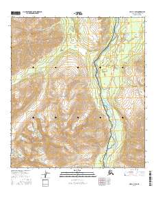
2016 Map of Healy C-4 SW
USGS Topo · Published 2016About this map
Denali National Park encompasses the western half of this Alaska interior landscape, where the high-altitude terrain of the Alaska Range descends toward the winding Nenana River. This 2016 survey documents the transportation corridor dominated by the Parks Highway, which follows the river valley through a wilderness of glacial drainages. The hydrology of the region is defined by several significant tributaries, including Riley Cr, Carlo Cr, and Slime Cr, which flow from the higher elevations to the west and east. To the northeast, the Deneki Lakes sit in a small basin just east of the highway. The map illustrates the sparse infrastructure characteristic of this region, focusing on the critical road artery that connects Anchorage and Fairbanks, while maintaining the protected boundaries of the national park.
Find a feature on this map
13 named features on this map. Tap any name to fly to it.
Don’t see what you’re looking for? This feature index may not catch every label — zoom into the map to look around manually.
Map Details
Editions of this 2016 Healy C-4 SW Map
This is the sole edition of this map. No revisions or reprints were ever made.
Other maps of this area

1949 · Healy B-4
USGS Topo · 1:63,360

1950 · Healy C-4
USGS Topo · 1:63,360

1950 · Healy B-5
USGS Topo · 1:63,360

1951 · Healy
USGS Topo · 1:250,000

1951 · Healy B-5
USGS Topo · 1:63,360

1951 · Healy B-4
USGS Topo · 1:63,360

1952 · Healy C-5
USGS Topo · 1:63,360
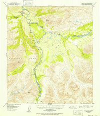
1952 · Healy C-4
USGS Topo · 1:63,360

1953 · Healy C-5
USGS Topo · 1:63,360

1953 · Healy B-5
USGS Topo · 1:63,360