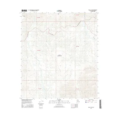
2016 Map of Healy C-5 NW
USGS Topo · Published 2016About this map
Denali National Park terrain defines this portion of the Alaska Range, where high-altitude ridges and glacial river valleys dominate the landscape. The Sanctuary River and Savage River flow northward through deep valleys, carved by the same forces that shaped the prominent Mt Wright and the long expanse of Primrose Ridge. This 2016 survey shows the critical infrastructure supporting travel through this interior wilderness, most notably the Denali National Park Road as it winds across the northern sections of the map. For those exploring the higher elevations, the Savage Alpine Trail provides a route along the ridges east of the rivers. The map serves as a contemporary record of federal land management, illustrating the vast roadless areas where seasonal waterways like Jenny Cr snake through the drainage basins of the central park interior.
Find a feature on this map
14 named features on this map. Tap any name to fly to it.
Don’t see what you’re looking for? This feature index may not catch every label — zoom into the map to look around manually.
Map Details
Editions of this 2016 Healy C-5 NW Map
This is the sole edition of this map. No revisions or reprints were ever made.
Other maps of this area

1951 · Healy
USGS Topo · 1:250,000

1951 · Healy D-6
USGS Topo · 1:63,360

1951 · Healy D-5
USGS Topo · 1:63,360

1952 · Healy D-5
USGS Topo · 1:63,360

1952 · Healy C-5
USGS Topo · 1:63,360

1953 · Healy C-5
USGS Topo · 1:63,360

1954 · Healy C-6
USGS Topo · 1:63,360
1954 · Healy D-6
USGS Topo · 1:63,360

1956 · Healy
USGS Topo · 1:250,000
2016 · Healy C-5 SW
USGS Topo · 1:25,000