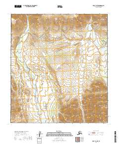
2019 Map of Healy C-5 NW
USGS Topo · Published 2019About this map
Denali National Park terrain is meticulously documented in this 2019 survey, focusing on the high-elevation corridors that define the park’s accessibility. The sheet traces the critical path of the Park Road as it winds through mountainous topography, providing the primary artery for transit through the wilderness. To the east, the Savage River corridor and Savage Campground Rd mark a significant area of recreational activity, while the Savage Alpine Trail offers a detailed look at the pedestrian routes established for backcountry exploration.
Find a feature on this map
14 named features on this map. Tap any name to fly to it.
Don’t see what you’re looking for? This feature index may not catch every label — zoom into the map to look around manually.
Map Details
Editions of this 2019 Healy C-5 NW Map
This is the sole edition of this map. No revisions or reprints were ever made.
Other maps of this area

1951 · Healy
USGS Topo · 1:250,000

1951 · Healy D-6
USGS Topo · 1:63,360

1951 · Healy D-5
USGS Topo · 1:63,360

1952 · Healy D-5
USGS Topo · 1:63,360

1952 · Healy C-5
USGS Topo · 1:63,360

1953 · Healy C-5
USGS Topo · 1:63,360

1954 · Healy C-6
USGS Topo · 1:63,360
1954 · Healy D-6
USGS Topo · 1:63,360

1956 · Healy
USGS Topo · 1:250,000
2016 · Healy C-5 SW
USGS Topo · 1:25,000