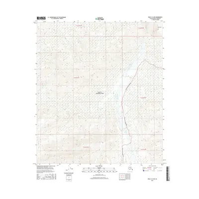
2016 Map of Healy C-6 NE
USGS Topo · Published 2016About this map
Denali National Park encompasses this high-altitude landscape, where the northern slopes are defined by the glacial drainage of the Teklanika River and the Sushana River. In this 2016 survey, the Denali National Park Road is the primary artery of human transit, winding through the eastern portion of the quadrangle along the Teklanika valley. The map documents a transition from the braided riverbeds in the lowlands to the sharp rise of Mt Wright in the northeast corner. This area serves as a critical point for understanding the preservation of subarctic ecosystems, showing the proximity of designated wilderness boundaries to the park's limited infrastructure. Small tributaries like Big Cr provide further detail on the hydrology of the Alaska Range's northern foothills.
Find a feature on this map
12 named features on this map. Tap any name to fly to it.
Don’t see what you’re looking for? This feature index may not catch every label — zoom into the map to look around manually.
Map Details
Editions of this 2016 Healy C-6 NE Map
This is the sole edition of this map. No revisions or reprints were ever made.
Other maps of this area

1951 · Healy
USGS Topo · 1:250,000

1951 · Healy D-6
USGS Topo · 1:63,360

1951 · Healy D-5
USGS Topo · 1:63,360

1952 · Healy D-5
USGS Topo · 1:63,360

1952 · Healy C-5
USGS Topo · 1:63,360

1953 · Healy C-5
USGS Topo · 1:63,360

1954 · Healy C-6
USGS Topo · 1:63,360
1954 · Healy D-6
USGS Topo · 1:63,360

1956 · Healy
USGS Topo · 1:250,000
2014 · Healy C-6 SW
USGS Topo · 1:25,000