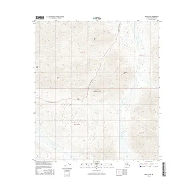
2016 Map of Healy C-6 SE
USGS Topo · Published 2016About this map
Denali National Park terrain dominates this 2016 survey, showcasing a high-altitude wilderness within the Alaska Range. The landscape is defined by massive peaks and the corridors carved by glacial waters, including the wide gravel beds of the Teklanika River and the East Fork Toklat River. The Denali National Park Road serves as the primary artery through this protected interior, winding through Sable Pass between the prominent elevations of Sable Mtn and Cathedral Mtn. The hydrology of the area is further marked by numerous tributaries such as Igloo Cr, which flows near the base of Igloo Mtn, and Big Cr to the northwest. This map illustrates the intersection of early 21st-century conservation boundaries and the timeless geologic features of the Alaskan interior, providing a clear record of the access routes and natural landmarks that define the park's central corridor.
Find a feature on this map
18 named features on this map. Tap any name to fly to it.
Don’t see what you’re looking for? This feature index may not catch every label — zoom into the map to look around manually.
Map Details
Editions of this 2016 Healy C-6 SE Map
This is the sole edition of this map. No revisions or reprints were ever made.
Other maps of this area

1950 · Healy B-5
USGS Topo · 1:63,360

1951 · Healy
USGS Topo · 1:250,000

1951 · Healy B-5
USGS Topo · 1:63,360

1952 · Healy C-5
USGS Topo · 1:63,360

1953 · Healy C-5
USGS Topo · 1:63,360

1953 · Healy B-5
USGS Topo · 1:63,360

1954 · Healy C-6
USGS Topo · 1:63,360

1954 · Healy B-6
USGS Topo · 1:63,360
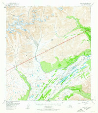
1956 · Healy B-5
USGS Topo · 1:63,360

1956 · Healy
USGS Topo · 1:250,000