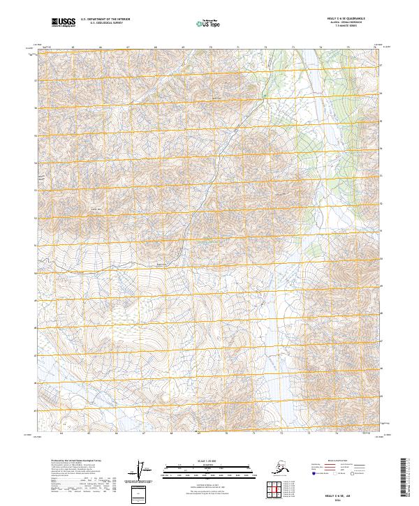
2024 Map of Healy C-6 SE
USGS Topo · Published 2024About this map
Sable Pass serves as a critical high point in this landscape, where the Park Road winds through the protected lands of Denali National Park. The topography is defined by significant peaks of the Alaska Range, including the towering Sable Mtn, Igloo Mtn, and Cathedral Mtn. This area within the Denali Wilderness is a complex drainage system where the Teklanika River and the East Fork Toklat River carve through the mountain terrain. Historically significant watercourses such as Big Creek, Igloo Creek, and Tattler Creek provide the primary hydrological structure for this portion of the interior. The map illustrates the singular path of human transit through this wilderness, following the narrow corridor of the Park Road as it navigates the steep elevation changes between river basins.
Find a feature on this map
18 named features on this map. Tap any name to fly to it.
Don’t see what you’re looking for? This feature index may not catch every label — zoom into the map to look around manually.
Map Details
Editions of this 2024 Healy C-6 SE Map
This is the sole edition of this map. No revisions or reprints were ever made.
Other maps of this area

1950 · Healy B-5
USGS Topo · 1:63,360

1951 · Healy
USGS Topo · 1:250,000

1951 · Healy B-5
USGS Topo · 1:63,360

1952 · Healy C-5
USGS Topo · 1:63,360

1953 · Healy C-5
USGS Topo · 1:63,360

1953 · Healy B-5
USGS Topo · 1:63,360

1954 · Healy C-6
USGS Topo · 1:63,360

1954 · Healy B-6
USGS Topo · 1:63,360
1956 · Healy B-5
USGS Topo · 1:63,360

1956 · Healy
USGS Topo · 1:250,000