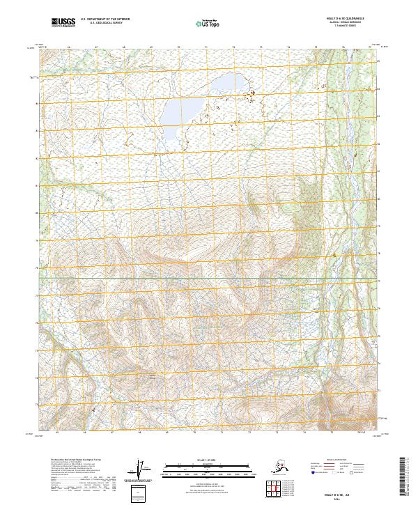
2024 Map of Healy D-6 SE
USGS Topo · Published 2024About this map
The Alaska Range defines the northern interior of this Alaskan landscape, where the southern reaches of the quadrangle are protected within the Denali Wilderness. This area, part of the larger Denali National Park, shows a wilderness environment largely untouched by modern infrastructure. The terrain is characterized by the northward flow of the Teklanika River and the Sanctuary River, which carve through the foothills of the range. The absence of roads or permanent settlements within the survey area reflects the strict conservation status of these protected lands. For researchers and wilderness enthusiasts, the map provides an essential look at the natural drainage patterns and topographical shifts from high peaks into the river valleys of the interior.
Find a feature on this map
9 named features on this map. Tap any name to fly to it.
Don’t see what you’re looking for? This feature index may not catch every label — zoom into the map to look around manually.
Map Details
Editions of this 2024 Healy D-6 SE Map
This is the sole edition of this map. No revisions or reprints were ever made.
Other maps of this area

1951 · Healy
USGS Topo · 1:250,000

1951 · Healy D-6
USGS Topo · 1:63,360

1951 · Healy D-5
USGS Topo · 1:63,360

1952 · Healy D-5
USGS Topo · 1:63,360

1952 · Healy C-5
USGS Topo · 1:63,360

1953 · Healy C-5
USGS Topo · 1:63,360

1954 · Healy C-6
USGS Topo · 1:63,360
1954 · Healy D-6
USGS Topo · 1:63,360

1956 · Healy
USGS Topo · 1:250,000
2014 · Healy D-6 NW
USGS Topo · 1:25,000