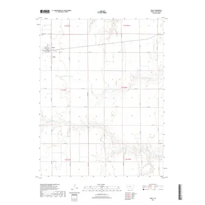
2018 Map of Healy
USGS Topo · Published 2018About this map
Healy serves as the primary hub in this western Kansas landscape, where a grid of rural roads such as Eagle Rd and Frontier Rd segment the High Plains terrain. The town itself is defined by a traditional street plan featuring Illinois Ave and Delaware Ave, with the Healy Cem located just to the northwest. This area of Lane County is marked by the winding drainages of the Walnut Creek system, specifically Middle Fork Walnut Cr and the N Fork Middle Fork Walnut Cr. The presence of Wilkens Airport south of the main settlement indicates the continued importance of regional aviation for agricultural and local transit. The map captures a transition where the sharp relief of northern draws like Cheyenne Cr gives way to the broader agricultural sections of the southern townships.
Find a feature on this map
31 named features on this map. Tap any name to fly to it.
Don’t see what you’re looking for? This feature index may not catch every label — zoom into the map to look around manually.
Map Details
Editions of this 2018 Healy Map
This is the sole edition of this map. No revisions or reprints were ever made.
Other maps of this area

1955 · Scott City
USGS Topo · 1:250,000

1958 · Scott City
USGS Topo · 1:250,000

1974 · Cheyenne Creek
USGS Topo · 1:24,000

1974 · Dighton
USGS Topo · 1:24,000

1974 · Healy NW
USGS Topo · 1:24,000

1974 · Grigston
USGS Topo · 1:24,000

1974 · Amy
USGS Topo · 1:24,000

1974 · Shields NW
USGS Topo · 1:24,000

1974 · Manning
USGS Topo · 1:24,000

1974 · Healy
USGS Topo · 1:24,000