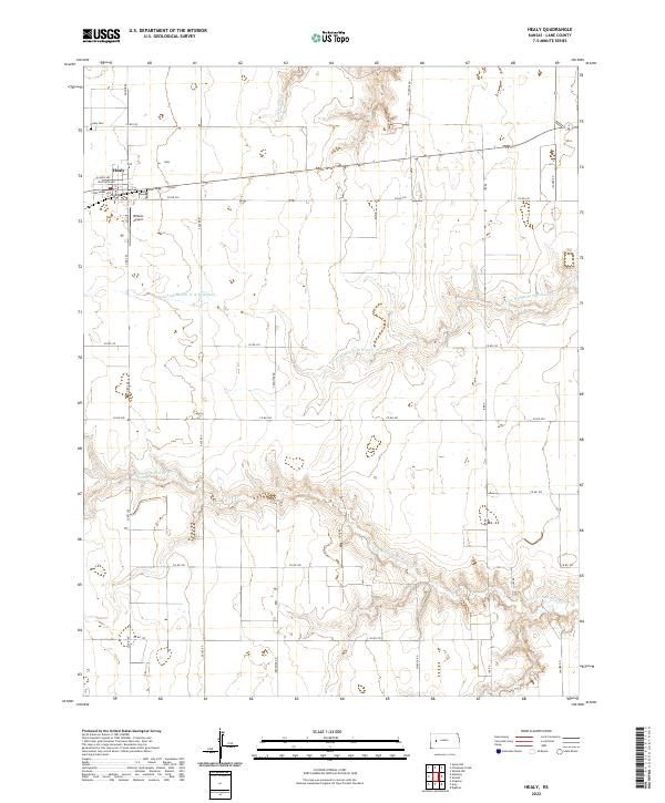
2022 Map of Healy
USGS Topo · Published 2022About this map
Healy serves as the primary hub of activity in this section of Lane County, with a residential street grid including Illinois Ave and Wisconsin Ave. The surrounding High Plains landscape is deeply etched by the drainage of the Middle Fork Walnut Cr, which meanders across the southern half of the quadrangle. North of the town, the Healy Cem and the Wilkens Airport stand as distinct landmarks amidst the rectangular grid of section lines and county roads like Eagle Rd and Frontier Rd. The map illustrates a classic western Kansas agricultural pattern, where watercourses like Cheyenne Cr and N Fork Middle Fork Walnut Cr provide the only major relief in an otherwise strictly surveyed landscape of section roads and farmsteads.
Find a feature on this map
32 named features on this map. Tap any name to fly to it.
Don’t see what you’re looking for? This feature index may not catch every label — zoom into the map to look around manually.
Map Details
Editions of this 2022 Healy Map
This is the sole edition of this map. No revisions or reprints were ever made.
Other maps of this area

1955 · Scott City
USGS Topo · 1:250,000

1958 · Scott City
USGS Topo · 1:250,000

1974 · Cheyenne Creek
USGS Topo · 1:24,000

1974 · Dighton
USGS Topo · 1:24,000

1974 · Healy NW
USGS Topo · 1:24,000

1974 · Grigston
USGS Topo · 1:24,000

1974 · Amy
USGS Topo · 1:24,000

1974 · Shields NW
USGS Topo · 1:24,000

1974 · Manning
USGS Topo · 1:24,000

1974 · Healy
USGS Topo · 1:24,000