
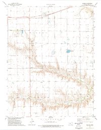
1974 Map of Healy
USGS Topo · Published 1977About this map
Healy serves as the primary hub of this High Plains landscape, situated along the Missouri Pacific railroad. The town's layout is centered around the rail line and a prominent Water Tank, reflecting the critical importance of transportation and water infrastructure in western Kansas. Outside the immediate settlement, the terrain is defined by the branching drainages of North Fork Walnut Creek, Middle Fork Walnut Creek, and Cheyenne Creek, which cut through the flat agricultural townships of Cheyenne, Wilson, Blaine, and Dighton.
Find a feature on this map
16 named features on this map. Tap any name to fly to it.
Don’t see what you’re looking for? This feature index may not catch every label — zoom into the map to look around manually.
Map Details
Editions of this 1974 Healy Map
This is the sole edition of this map. No revisions or reprints were ever made.
Other maps of this area

1955 · Scott City
USGS Topo · 1:250,000

1958 · Scott City
USGS Topo · 1:250,000

1974 · Cheyenne Creek
USGS Topo · 1:24,000

1974 · Dighton
USGS Topo · 1:24,000

1974 · Healy NW
USGS Topo · 1:24,000

1974 · Grigston
USGS Topo · 1:24,000

1974 · Amy
USGS Topo · 1:24,000

1974 · Shields NW
USGS Topo · 1:24,000

1974 · Manning
USGS Topo · 1:24,000
1974 · Shields
USGS Topo · 1:24,000