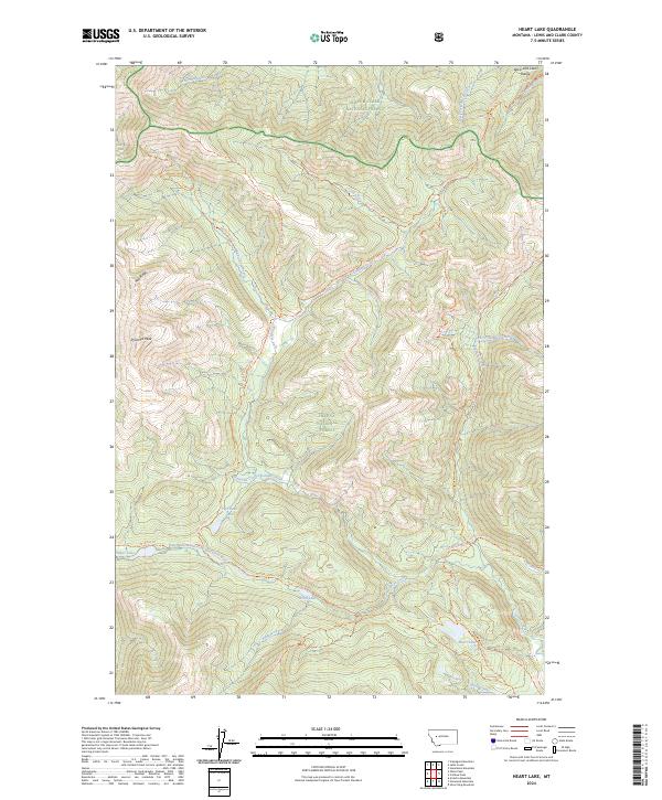
2024 Map of Heart Lake
USGS Topo · Published 2024About this map
The Lewis and Clark Range defines the high-altitude hydrology of this wild region, where the Continental Divide National Scenic Trl traverses the northern peaks. This interior landscape is protected within the Scapegoat Wilderness, straddling the boundary between the Helena National Forest and the Lewis & Clark National Forest. The map documents a complex system of drainage and backcountry access, anchored by the Landers Fork and its numerous tributaries such as Ringeye Creek and Maryann Creek. A network of high-country routes including the Crow Peak Trl and Upper Landers Trl connect isolated water bodies like Heart Lake, Webb Lake, and Two Point Lake. Significant topographical landmarks such as Pyramid Peak and Red Ridge overlook the headwaters of the East Fork North Fork Blackfoot River.
Find a feature on this map
37 named features on this map. Tap any name to fly to it.
Don’t see what you’re looking for? This feature index may not catch every label — zoom into the map to look around manually.
Map Details
Editions of this 2024 Heart Lake Map
This is the sole edition of this map. No revisions or reprints were ever made.
Other maps of this area

1903 · Coopers Lake
USGS Topo · 1:125,000

1955 · Choteau
USGS Topo · 1:250,000

1957 · Choteau
USGS Topo · 1:250,000

1958 · Choteau
USGS Topo · 1:250,000

1962 · Choteau
USGS Topo · 1:250,000

1968 · Heart Lake
USGS Topo · 1:24,000

1968 · Olson Peak
USGS Topo · 1:24,000
1968 · Stonewall Mountain
USGS Topo · 1:24,000
1968 · Caribou Peak
USGS Topo · 1:24,000
1968 · Arrastra Mountain
USGS Topo · 1:24,000