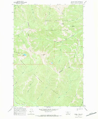
1968 Map of Caribou Peak
USGS Topo · Published 1971About this map
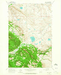
The Continental Divide winds through this high-altitude landscape in the late 1960s, marking the boundary between the Lewis and Clark National Forest and the Helena National Forest. The terrain is defined by prominent summits such as Caribou Peak and Monitor Mountain, which serve as the headwaters for a dense network of mountain streams. This topography is dominated by steep drainages, including the uniquely named Baking Powder Creek and Fickler Creek, which flow southward away from the divide. Remote backcountry travel is indicated by the West Fork Falls Trail and the Caribou Divide Trail, providing access to high-elevation water bodies like Bighorn Lake. The presence of pack trails suggests a landscape primarily utilized for wilderness management and seasonal recreation, far removed from permanent settlements.
Find a feature on this map
29 named features on this map. Tap any name to fly to it.
Don’t see what you’re looking for? This feature index may not catch every label — zoom into the map to look around manually.
Map Details
Editions of this 1968 Caribou Peak Map
2 editions found
Other maps of this area

1903 · Coopers Lake
USGS Topo · 1:125,000

1943 · Hogan
USGS Topo · 1:125,000

1955 · Choteau
USGS Topo · 1:250,000

1957 · Choteau
USGS Topo · 1:250,000

1958 · Choteau
USGS Topo · 1:250,000

1962 · Choteau
USGS Topo · 1:250,000
1963 · Cadotte Creek
USGS Topo · 1:24,000
1963 · Blowout Mountain
USGS Topo · 1:24,000
1963 · Bean Lake
USGS Topo · 1:24,000

1968 · Heart Lake
USGS Topo · 1:24,000