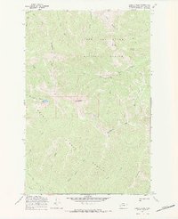
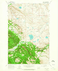
1968 Map of Caribou Peak
USGS Topo · Published 1984About this map
The Continental Divide winds through this high-elevation landscape, marking the boundary between the Helena National Forest and Lewis and Clark National Forest. Centered on the prominence of Caribou Peak, the map details a complex network of drainages and seasonal watercourses including Baking Powder Creek and Alice Creek. This 1960s survey illustrates a wilderness defined by its absence of permanent settlements, focused instead on the topographical reality of peaks like Monitor Mountain and Bear Den Mountain. Human presence is marked primarily by historic routes such as the Caribou Trail and Falls Trail, which navigate the steep terrain surrounding Bighorn Lake. The intricate contouring around Skull Gulch and Toms Gulch provides a clear view of the watersheds that feed the various forks of the Missouri River system at this high altitude.
Find a feature on this map
26 named features on this map. Tap any name to fly to it.
Don’t see what you’re looking for? This feature index may not catch every label — zoom into the map to look around manually.
Map Details
Editions of this 1968 Caribou Peak Map
2 editions found
Other maps of this area

1903 · Coopers Lake
USGS Topo · 1:125,000

1943 · Hogan
USGS Topo · 1:125,000

1955 · Choteau
USGS Topo · 1:250,000

1957 · Choteau
USGS Topo · 1:250,000

1958 · Choteau
USGS Topo · 1:250,000

1962 · Choteau
USGS Topo · 1:250,000
1963 · Cadotte Creek
USGS Topo · 1:24,000
1963 · Blowout Mountain
USGS Topo · 1:24,000
1963 · Bean Lake
USGS Topo · 1:24,000

1968 · Heart Lake
USGS Topo · 1:24,000