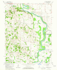
1964 Map of Heathsville
USGS Topo · Published 1965About this map
The Wabash River serves as the central artery and natural state line on this mid-century survey, dividing Illinois from Indiana. Along its western bank, the town of Palestine stands near Leaverton Park, while the smaller settlement of Heathsville anchors the southern portion of the sheet. The landscape is heavily marked by its proximity to the water, featuring complex fluvial landforms such as Johnsons Cutoff, Horseshoe Cutoff, and Minnow Slough.
Find a feature on this map
51 named features on this map. Tap any name to fly to it.
Don’t see what you’re looking for? This feature index may not catch every label — zoom into the map to look around manually.
Map Details
Editions of this 1964 Heathsville Map
3 editions found
Other maps of this area

1917 · Birds
USGS Topo · 1:62,500

1942 · Birds
USGS Topo · 1:62,500

1943 · Merom
USGS Topo · 1:24,000

1943 · Carlisle
USGS Topo · 1:24,000

1943 · Oaktown
USGS Topo · 1:24,000

1943 · Sullivan
USGS Topo · 1:24,000

1953 · Indianapolis
USGS Topo · 1:250,000

1956 · Indianapolis
USGS Topo · 1:250,000
1956 · Sullivan
USGS Topo · 1:24,000

1956 · Vincennes
USGS Topo · 1:250,000