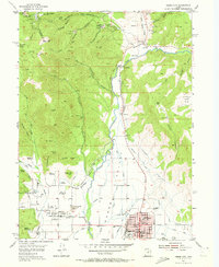
1955 Map of Heber City
USGS Topo · Published 1972About this map
The agricultural and hydraulic infrastructure of the Heber Valley dominates this mid-century landscape, centered on the grid of Heber City and the nearby town of Midway. The Provo River winds through the heart of the quadrangle, flanked by a complex network of man-made waterways including the Spring Creek Canal, Humbug Canal, and the Aqueduct. This era captures the valley before major modern reservoir projects altered the course of the river and the surrounding settlements.
Find a feature on this map
61 named features on this map. Tap any name to fly to it.
Don’t see what you’re looking for? This feature index may not catch every label — zoom into the map to look around manually.
Map Details
Editions of this 1955 Heber City Map
5 editions found

Other maps of this area

1885 · Salt Lake
USGS Topo · 1:250,000

1900 · Coalville
USGS Topo · 1:125,000

1903 · Coalville
USGS Topo · 1:125,000

1907 · Strawberry Valley
USGS Topo · 1:125,000

1909 · Strawberry Valley
USGS Topo · 1:125,000

1925 · Ft. Douglas
USGS Topo · 1:125,000

1928 · Ft. Douglas
USGS Topo · 1:125,000

1948 · Orem
USGS Topo · 1:62,500

1948 · Aspen Grove
USGS Topo · 1:24,000

1950 · Aspen Grove
USGS Topo · 1:24,000