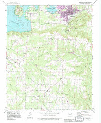
1989 Map of Heber Springs
USGS Topo · Published 1995About this map
Heber Springs sits at a geographic crossroads in the late 1980s, where the expansion of Greers Ferry Lake meets the established agricultural and timber landscapes of Cleburne County. The town is marked by local civic landmarks like the Fairground and several water tanks, while the surrounding rural areas are dotted with country houses of worship including Mt Olive Ch, Stacy Springs Ch, and Crossroads Ch. These small religious and burial sites, such as the Cove-Kendall Cem, provide a dense record of family settlement patterns north of Hopewell.
Find a feature on this map
48 named features on this map. Tap any name to fly to it.
Don’t see what you’re looking for? This feature index may not catch every label — zoom into the map to look around manually.
Map Details
Editions of this 1989 Heber Springs Map
This is the sole edition of this map. No revisions or reprints were ever made.
Other maps of this area

1890 · Batesville
USGS Topo · 1:125,000

1891 · Batesville
USGS Topo · 1:125,000

1892 · Mountain View
USGS Topo · 1:125,000

1894 · Mountain View
USGS Topo · 1:125,000

1953 · Memphis
USGS Topo · 1:250,000

1956 · Memphis
USGS Topo · 1:250,000

1956 · Russellville
USGS Topo · 1:250,000

1963 · Rose Bud
USGS Topo · 1:24,000

1963 · Quitman
USGS Topo · 1:24,000

1963 · West Pangburn
USGS Topo · 1:24,000