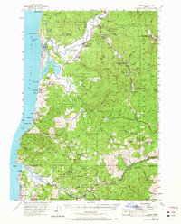
1955 Map of Hebo
USGS Topo · Published 1965About this map
The Nestucca River and its various tributaries define this coastal region of Tillamook County during the mid-1950s. Settlement patterns follow the river valleys and the winding path of the Coast Highway, with small communities like Cloverdale and Woods serving as inland anchors. Along the shore, Pacific City sits at the mouth of Nestucca Bay, sheltered by the prominent Cape Kiwanda. The interior is dominated by the Siuslaw National Forest, where infrastructure for land management is evident at the Hebo Ranger Sta and the Salmon River Guard Station. Educational and community life is centered at the Nestucca Union High School and Cloverdale School, while the presence of the Town Lake Cemetery provides a specific point of interest for those researching local family histories and early burials in the area.
Find a feature on this map
103 named features on this map. Tap any name to fly to it.
Don’t see what you’re looking for? This feature index may not catch every label — zoom into the map to look around manually.
Map Details
Editions of this 1955 Hebo Map
3 editions found

Other maps of this area

1941 · Nestucca Bay
USGS Topo · 1:62,500

1941 · Cape Foulweather
USGS Topo · 1:62,500

1942 · Ginger Peak
USGS Topo · 1:62,500

1942 · Euchre Mtn
USGS Topo · 1:62,500

1942 · Spirit Mtn
USGS Topo · 1:62,500

1942 · Nestucca Bay
USGS Topo · 1:62,500

1942 · Valsetz
USGS Topo · 1:62,500

1942 · Tillamook
USGS Topo · 1:62,500

1943 · Euchre Mtn
USGS Topo · 1:62,500

1944 · Cape Foulweather
USGS Topo · 1:62,500