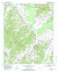
1950 Map of Hebron
USGS Topo · Published 1983About this map
Hebron serves as a central point in this mid-century survey of the Hardeman County landscape, where the Hatchie River meanders through the expansive marshy terrain of The Big Bottom. The map reveals a rural economy organized around small community hubs, evidenced by a high density of country schools and churches that anchored local life before the era of widespread consolidation. From Oak Hill Sch in the north to Mt Olive Sch and Burnette Sch in the south, these landmarks provide vital coordinates for genealogical research. Along the edges of Hatchie River, features like Hayes Branch and Porters Creek define the drainage patterns of the region, while family-named burial sites such as Salem Cem and Harris Cem offer precise locations for tracing ancestral homesteads near the city of Bolivar.
Find a feature on this map
27 named features on this map. Tap any name to fly to it.
Don’t see what you’re looking for? This feature index may not catch every label — zoom into the map to look around manually.
Map Details
Editions of this 1950 Hebron Map
3 editions found
Other maps of this area

1950 · Pocahontas
USGS Topo · 1:24,000

1950 · Hebron
USGS Topo · 1:24,000

1950 · Hornsby
USGS Topo · 1:24,000

1950 · Middleburg
USGS Topo · 1:24,000

1950 · Middleton
USGS Topo · 1:24,000

1951 · Middleton
USGS Topo · 1:24,000

1951 · Middleburg
USGS Topo · 1:24,000

1951 · Hebron
USGS Topo · 1:24,000

1951 · Hornsby
USGS Topo · 1:24,000

1952 · Pocahontas
USGS Topo · 1:24,000