
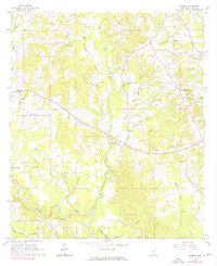
1965 Map of Hebron
USGS Topo · Published 1966About this map
Hebron serves as the primary settlement hub in this rural landscape of Jones County, situated where winding waterways and local roads intersect. The topography is dominated by the meandering Leaf River along the southern edge and the central corridor of Big Creek, which is fed by numerous tributaries such as Harper Branch and Deadman Creek. This mid-century survey reveals a deeply established community identity rooted in local congregations and family landmarks. Small rural churches like Mt William Ch, Morning Star Ch, and Sweet Beulah Ch are scattered throughout the hills. Evidence of local industry and resource extraction is visible through markings for a Mill on Deadman Creek and a Claypit to the north, while several family and community burial grounds, including Welch Cem and Hill Cem, offer critical data points for genealogical research.
Find a feature on this map
32 named features on this map. Tap any name to fly to it.
Don’t see what you’re looking for? This feature index may not catch every label — zoom into the map to look around manually.
Map Details
Editions of this 1965 Hebron Map
3 editions found
Other maps of this area

1953 · Hattiesburg
USGS Topo · 1:250,000

1958 · Hattiesburg
USGS Topo · 1:250,000

1964 · Moss
USGS Topo · 1:24,000

1964 · Laurel West
USGS Topo · 1:24,000

1964 · Seminary
USGS Topo · 1:24,000

1964 · Ellisville
USGS Topo · 1:24,000

1965 · Hot Coffee
USGS Topo · 1:24,000

1965 · Moselle
USGS Topo · 1:24,000

1974 · Soso
USGS Topo · 1:24,000

1975 · Taylorsville
USGS Topo · 1:24,000