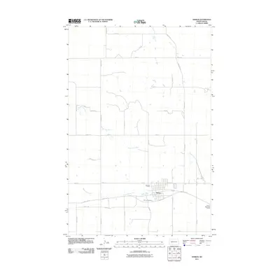
2011 Map of Hebron
USGS Topo · Published 2011About this map
Hebron serves as the primary hub of activity in this portion of Morton County, North Dakota, defined by its grid-patterned streets like Summit Ave and Main Ave. The surrounding landscape is dominated by the winding path of the Branch Knife River, which meanders through the prairie north and west of the city center. This 2011 survey reveals a settlement deeply integrated with its transportation corridors, where County Rd 139 and several north-south avenues provide essential links between rural homesteads and the town proper. Local genealogy and history are anchored by Saint John Cemetery and Saint Ann Cemetery, both located on the outskirts of the residential area. The Hebron Municipal Airport on the eastern edge of the quadrangle marks the intersection of traditional agriculture and modern infrastructure in this High Plains community.
Find a feature on this map
31 named features on this map. Tap any name to fly to it.
Don’t see what you’re looking for? This feature index may not catch every label — zoom into the map to look around manually.
Map Details
Editions of this 2011 Hebron Map
This is the sole edition of this map. No revisions or reprints were ever made.
Other maps of this area

1953 · Dickinson
USGS Topo · 1:250,000

1953 · Watford City
USGS Topo · 1:250,000

1954 · Bismarck
USGS Topo · 1:250,000

1954 · McClusky
USGS Topo · 1:250,000

1957 · Dickinson
USGS Topo · 1:250,000

1957 · Watford City
USGS Topo · 1:250,000

1958 · Bismarck
USGS Topo · 1:250,000

1958 · McClusky
USGS Topo · 1:250,000

1967 · Watford City
USGS Topo · 1:250,000
1970 · Glen Ullin NW
USGS Topo · 1:24,000