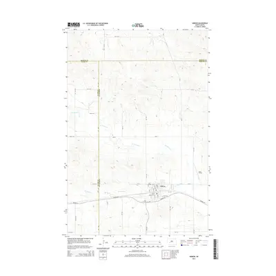
2014 Map of Hebron
USGS Topo · Published 2014About this map
The community of Hebron anchors this 2014 survey, positioned at the intersection of the Morton, Stark, and Mercer county lines. The landscape is defined by the winding course of the Br Knife River, which meanders through the undulating terrain north of the city center. Historical local data is preserved in the location of Saint John Cem and Saint Ann Cem, while the regional transport network is represented by Highway 10 and Coroad 139. Beyond the residential blocks of Hebron, the area transitions to a grid of rural routes including 35th St SW and 74th Ave, supporting a remote agricultural and aviation corridor marked by the Chase Airstrip.
Find a feature on this map
40 named features on this map. Tap any name to fly to it.
Don’t see what you’re looking for? This feature index may not catch every label — zoom into the map to look around manually.
Map Details
Editions of this 2014 Hebron Map
This is the sole edition of this map. No revisions or reprints were ever made.
Other maps of this area

1953 · Dickinson
USGS Topo · 1:250,000

1953 · Watford City
USGS Topo · 1:250,000

1954 · Bismarck
USGS Topo · 1:250,000

1954 · McClusky
USGS Topo · 1:250,000

1957 · Dickinson
USGS Topo · 1:250,000

1957 · Watford City
USGS Topo · 1:250,000

1958 · Bismarck
USGS Topo · 1:250,000

1958 · McClusky
USGS Topo · 1:250,000

1967 · Watford City
USGS Topo · 1:250,000
1970 · Glen Ullin NW
USGS Topo · 1:24,000