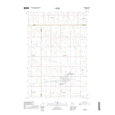
2018 Map of Hebron
USGS Topo · Published 2018About this map
Hebron serves as the central hub of this North Dakota landscape, situated at the crossroads of three counties: Morton, Stark, and Mercer. The town's layout reflects a strong communal and religious foundation, evidenced by a dense concentration of denominational burial grounds including the Saint John Cem, First United Methodist Church Cem, and the English Congregational Church Cem. These sites, along with others like the Seventh Day Adventist Cem, provide a detailed record for genealogists researching the area's pioneer families and early congregations.
Find a feature on this map
61 named features on this map. Tap any name to fly to it.
Don’t see what you’re looking for? This feature index may not catch every label — zoom into the map to look around manually.
Map Details
Editions of this 2018 Hebron Map
This is the sole edition of this map. No revisions or reprints were ever made.
Other maps of this area

1953 · Dickinson
USGS Topo · 1:250,000

1953 · Watford City
USGS Topo · 1:250,000

1954 · Bismarck
USGS Topo · 1:250,000

1954 · McClusky
USGS Topo · 1:250,000

1957 · Dickinson
USGS Topo · 1:250,000

1957 · Watford City
USGS Topo · 1:250,000

1958 · Bismarck
USGS Topo · 1:250,000

1958 · McClusky
USGS Topo · 1:250,000

1967 · Watford City
USGS Topo · 1:250,000
1970 · Glen Ullin NW
USGS Topo · 1:24,000