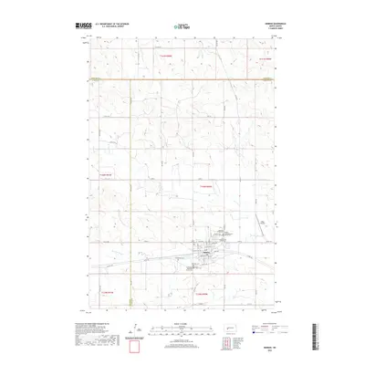
2020 Map of Hebron
USGS Topo · Published 2020About this map
Hebron serves as the central hub of this North Dakota landscape, situated at the junction of three counties: Morton, Stark, and Mercer. The town's layout is deeply rooted in its local institutions, evidenced by a high density of religious burial grounds including Saint Ann Cem, Saint John Cem, and the First United Methodist Church Cem. The surrounding plains are drained by the Br Knife River, while a grid of rural roads like 78th Ave and 35th St connects the outlying farmsteads. Transportation and industry are reflected in the presence of Chase Airstrip to the east and Brickmaker Expy, which parallels the main east-west corridor through town. This documentation highlights a resilient prairie community where legacy church sites like the English Congregational Church Cem remain prominent features of the modern topography.
Find a feature on this map
52 named features on this map. Tap any name to fly to it.
Don’t see what you’re looking for? This feature index may not catch every label — zoom into the map to look around manually.
Map Details
Editions of this 2020 Hebron Map
This is the sole edition of this map. No revisions or reprints were ever made.
Other maps of this area

1953 · Dickinson
USGS Topo · 1:250,000

1953 · Watford City
USGS Topo · 1:250,000

1954 · Bismarck
USGS Topo · 1:250,000

1954 · McClusky
USGS Topo · 1:250,000

1957 · Dickinson
USGS Topo · 1:250,000

1957 · Watford City
USGS Topo · 1:250,000

1958 · Bismarck
USGS Topo · 1:250,000

1958 · McClusky
USGS Topo · 1:250,000

1967 · Watford City
USGS Topo · 1:250,000
1970 · Glen Ullin NW
USGS Topo · 1:24,000