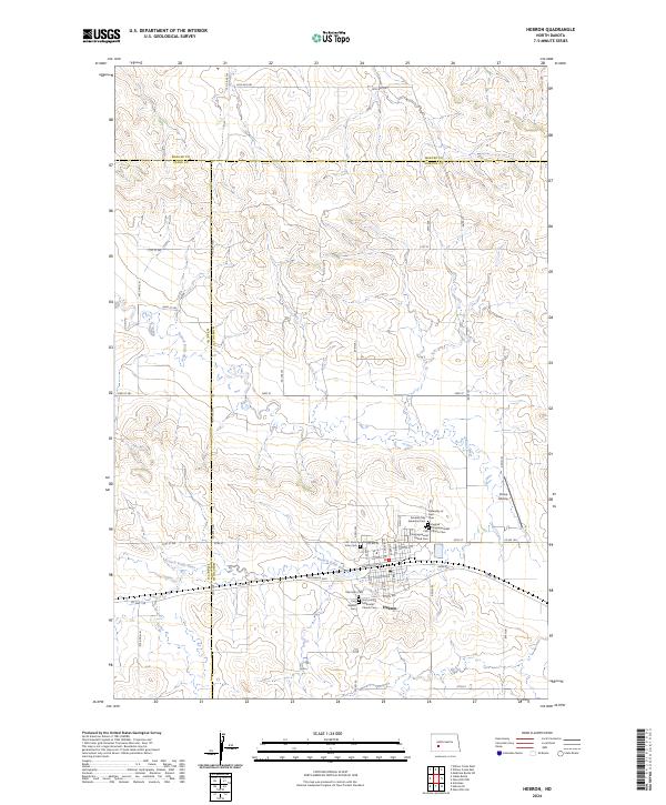
2024 Map of Hebron
USGS Topo · Published 2024About this map
The city of Hebron serves as the focal point for this contemporary survey of Morton County, where the plains are defined by the winding course of the Branch Knife River. The area's deep-rooted community history is evidenced by an unusual density of religious and family burial sites, including the First United Church Cem, Saint Ann Cem, and the Seventh Day Adventist Cem clustered near the town site. The map details a transition from the structured residential grid of streets like Lincoln Ave and Main Ave to the vast agricultural sections of the surrounding prairie. Industrial and transport footprints are visible in the Brickmaker Expy and the Chase Airstrip, while county lines for Stark and Mercer intersect just north of the settlement, illustrating the complex administrative boundaries of this North Dakota landscape.
Find a feature on this map
68 named features on this map. Tap any name to fly to it.
Don’t see what you’re looking for? This feature index may not catch every label — zoom into the map to look around manually.
Map Details
Editions of this 2024 Hebron Map
This is the sole edition of this map. No revisions or reprints were ever made.
Other maps of this area

1953 · Dickinson
USGS Topo · 1:250,000

1953 · Watford City
USGS Topo · 1:250,000

1954 · Bismarck
USGS Topo · 1:250,000

1954 · McClusky
USGS Topo · 1:250,000

1957 · Dickinson
USGS Topo · 1:250,000

1957 · Watford City
USGS Topo · 1:250,000

1958 · Bismarck
USGS Topo · 1:250,000

1958 · McClusky
USGS Topo · 1:250,000

1967 · Watford City
USGS Topo · 1:250,000
1970 · Glen Ullin NW
USGS Topo · 1:24,000