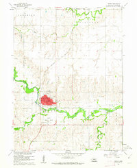
1960 Map of Hebron
USGS Topo · Published 1962About this map
Hebron serves as a critical junction for Nebraska rail travel in the early 1960s, situated at the confluence of three major systems: the Union Pacific, the Chicago Burlington and Quincy, and the Chicago Rock Island and Pacific. The town center is densely structured with civic and social landmarks, including the Courthouse, Post Office, and a High School, alongside the Sacred Heart Church and its associated Sacred Heart School.
Find a feature on this map
30 named features on this map. Tap any name to fly to it.
Don’t see what you’re looking for? This feature index may not catch every label — zoom into the map to look around manually.
Map Details
Editions of this 1960 Hebron Map
2 editions found
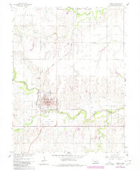
Other maps of this area

1898 · Hebron
USGS Topo · 1:125,000

1955 · Lincoln
USGS Topo · 1:250,000

1957 · Lincoln
USGS Topo · 1:250,000

1958 · Lincoln
USGS Topo · 1:250,000

1960 · Bruning
USGS Topo · 1:24,000

1960 · Chester
USGS Topo · 1:24,000

1960 · Hubbell
USGS Topo · 1:24,000

1960 · Carleton
USGS Topo · 1:24,000

1960 · Tobias SW
USGS Topo · 1:24,000

1960 · Alexandria
USGS Topo · 1:24,000