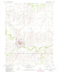
1960 Map of Hebron
USGS Topo · Published 1980About this map
The city of Hebron serves as the focal point of this Thayer County survey, appearing as a developed hub during the mid-twentieth century. The landscape is defined by the winding course of the Little Blue River, which flows south of the city center, and the confluence of northern tributaries like Big Sandy Creek. Cultural and civic infrastructure is densely documented in the town core, including the Courthouse, Po, and several educational facilities such as the High Sch and Sacred Heart Sch.
Find a feature on this map
29 named features on this map. Tap any name to fly to it.
Don’t see what you’re looking for? This feature index may not catch every label — zoom into the map to look around manually.
Map Details
Editions of this 1960 Hebron Map
2 editions found
Other maps of this area

1898 · Hebron
USGS Topo · 1:125,000

1955 · Lincoln
USGS Topo · 1:250,000

1957 · Lincoln
USGS Topo · 1:250,000

1958 · Lincoln
USGS Topo · 1:250,000

1960 · Bruning
USGS Topo · 1:24,000

1960 · Chester
USGS Topo · 1:24,000

1960 · Hubbell
USGS Topo · 1:24,000

1960 · Carleton
USGS Topo · 1:24,000

1960 · Tobias SW
USGS Topo · 1:24,000

1960 · Alexandria
USGS Topo · 1:24,000