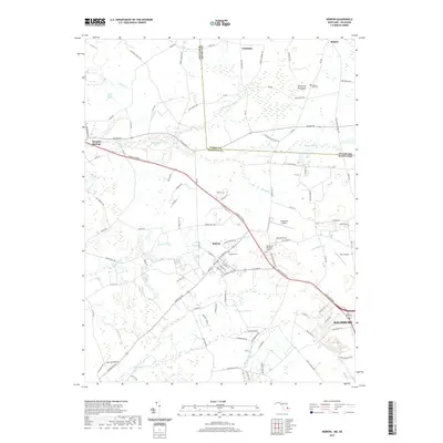
2019 Map of Hebron
USGS Topo · Published 2019About this map
Hebron sits at the intersection of local history and modern transit, centered along the Ocean Gateway as it cuts through the Wicomico County landscape. This 2019 survey captures the developed corridor stretching toward the outskirts of Salisbury, where the environment transitions from the residential streets of the town center to the agricultural fields and wetlands of the Delmarva Peninsula. The map documents a geography defined by its hydrology, where numerous waterways like Quantico Cr, Rewastico Cr, and Porter Mill Cr snake through the terrain. Notable local landmarks include the Spring Hill Airport and the Spring Hill Memorial Garden, while older sites like Hebron Cem and Ralph's Hill Cem offer points of interest for genealogists tracking local families. The northern boundary is marked by the Maryland Delaware state line, reflecting the political borders that divide this coastal plain.
Find a feature on this map
108 named features on this map. Tap any name to fly to it.
Don’t see what you’re looking for? This feature index may not catch every label — zoom into the map to look around manually.
Map Details
Editions of this 2019 Hebron Map
This is the sole edition of this map. No revisions or reprints were ever made.
Other maps of this area

1901 · Salisbury
USGS Topo · 1:62,500

1903 · Nanticoke
USGS Topo · 1:62,500

1905 · Hurlock
USGS Topo · 1:62,500

1915 · Seaford
USGS Topo · 1:62,500

1942 · Wetipquin
USGS Topo · 1:24,000

1942 · Mardela Springs
USGS Topo · 1:24,000

1942 · Eden
USGS Topo · 1:24,000

1942 · Hebron
USGS Topo · 1:24,000

1942 · Salisbury
USGS Topo · 1:24,000

1942 · Delmar
USGS Topo · 1:24,000