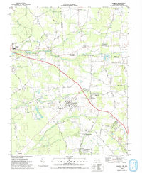
1992 Map of Hebron
USGS Topo · Published 1992About this map
The boundary between Delaware and Maryland cuts across the northern reaches of this landscape, marking the transition between Sussex and Wicomico counties. The town of Hebron serves as a central hub, where residential clusters sit near the Hebron Cemetery and Hebron Lions Park. Transportation history is etched into the terrain by the Old Railroad and sections of Old Railroad Grade that once connected these rural communities.
Find a feature on this map
69 named features on this map. Tap any name to fly to it.
Don’t see what you’re looking for? This feature index may not catch every label — zoom into the map to look around manually.
Map Details
Editions of this 1992 Hebron Map
This is the sole edition of this map. No revisions or reprints were ever made.
Other maps of this area

1901 · Salisbury
USGS Topo · 1:62,500

1903 · Nanticoke
USGS Topo · 1:62,500

1905 · Hurlock
USGS Topo · 1:62,500

1915 · Seaford
USGS Topo · 1:62,500

1942 · Wetipquin
USGS Topo · 1:24,000

1942 · Mardela Springs
USGS Topo · 1:24,000

1942 · Eden
USGS Topo · 1:24,000

1942 · Hebron
USGS Topo · 1:24,000

1942 · Salisbury
USGS Topo · 1:24,000

1942 · Delmar
USGS Topo · 1:24,000