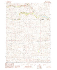
1987 Map of Hecla
USGS Topo · Published 1987About this map
Hecla sits along the southern edge of the Middle Loup River valley in the Nebraska Sandhills during the late 1980s. This survey illustrates the intricate drainage patterns of the river's various forks, including the North Branch and South Branch, which carve through the dune-like terrain of the High Plains. The settlement is centered on the Burlington Northern railroad line, which provides the primary transportation artery through this sparsely populated ranching country. Spanning the boundary between Cherry Co and Hooker Co, the map reveals a landscape defined by dramatic topographical contours and the vital water resources that supported the regional cattle industry and small rail-stop communities in the twentieth century.
Find a feature on this map
6 named features on this map. Tap any name to fly to it.
Don’t see what you’re looking for? This feature index may not catch every label — zoom into the map to look around manually.
Map Details
Editions of this 1987 Hecla Map
This is the sole edition of this map. No revisions or reprints were ever made.
Other maps of this area

1947 · Dismal River Ranch
USGS Topo · 1:62,500

1948 · Carr Lake
USGS Topo · 1:62,500

1948 · Mullen
USGS Topo · 1:62,500

1949 · Dismal River Ranch
USGS Topo · 1:62,500

1950 · Carr Lake
USGS Topo · 1:62,500

1950 · Hire
USGS Topo · 1:62,500

1951 · Mullen
USGS Topo · 1:62,500

1954 · North Platte
USGS Topo · 1:250,000

1956 · North Platte
USGS Topo · 1:250,000

1957 · North Platte
USGS Topo · 1:250,000