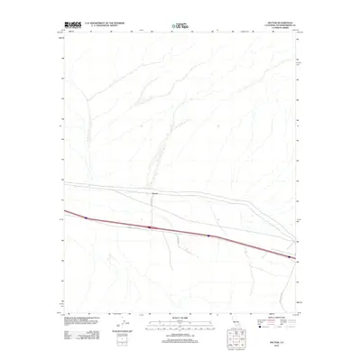
2012 Map of Hector
USGS Topo · Published 2012About this map
Hector serves as the primary focal point of this Mojave Desert landscape, situated where the high-speed transit corridors meet the arid alluvial fans of San Bernardino County. The settlement is positioned along the southern edge of the sheet, defined by the convergence of local infrastructure like Hector Rd and major regional thoroughfares. The southern portion of the map is dominated by the National Trails Hwy, a route that carries the legacy of mid-century transcontinental travel across the California interior. This 2012 survey illustrates the sparse, utilitarian nature of the region's development, characterized by desert access roads such as Pisgah Crater Rd and Co Hwy 20796 which strike out across the wash-carved terrain toward the north and east.
Find a feature on this map
5 named features on this map. Tap any name to fly to it.
Don’t see what you’re looking for? This feature index may not catch every label — zoom into the map to look around manually.
Map Details
Editions of this 2012 Hector Map
This is the sole edition of this map. No revisions or reprints were ever made.
Other maps of this area

1953 · San Bernardino
USGS Topo · 1:250,000

1955 · Silver Bell Mine
USGS Topo · 1:24,000

1955 · Sunshine Peak
USGS Topo · 1:24,000

1955 · Lavic Lake
USGS Topo · 1:24,000

1955 · Newberry
USGS Topo · 1:62,500

1955 · Lavic
USGS Topo · 1:62,500

1955 · Cady Mountains
USGS Topo · 1:62,500

1955 · Rodman Mountains
USGS Topo · 1:62,500

1956 · San Bernardino
USGS Topo · 1:250,000

1957 · San Bernardino
USGS Topo · 1:250,000