
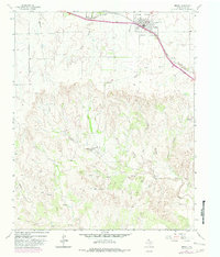
1963 Map of Hedley
USGS Topo · Published 1965About this map
The town of Hedley sits at the intersection of the Fort Worth and Denver railroad and the highway, serving as the primary hub of this High Plains landscape. The map shows a clear transition from the relatively flat terrain surrounding the settlement to the deeply incised drainage systems that feed the Red River basin to the south. This transition is marked by numerous seasonal waterways, including Oklahoma Draw and South Fork Buck Creek, which carve through the land south of the rail line.
Find a feature on this map
19 named features on this map. Tap any name to fly to it.
Don’t see what you’re looking for? This feature index may not catch every label — zoom into the map to look around manually.
Map Details
Editions of this 1963 Hedley Map
2 editions found
Other maps of this area

1954 · Plainview
USGS Topo · 1:250,000

1958 · Plainview
USGS Topo · 1:250,000

1959 · Lelia Lake Creek
USGS Topo · 1:24,000

1959 · McKnight
USGS Topo · 1:24,000

1960 · Brice
USGS Topo · 1:62,500

1961 · Memphis
USGS Topo · 1:62,500

1962 · Lelia Lake
USGS Topo · 1:24,000

1963 · Clarendon SE
USGS Topo · 1:24,000

1963 · Giles
USGS Topo · 1:24,000

1976 · Memphis NW
USGS Topo · 1:24,000