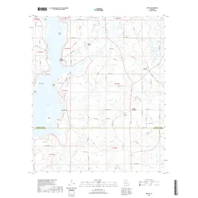
2018 Map of Heflin
USGS Topo · Published 2018About this map
Heflin and Yellow Pine anchor this portion of the Louisiana landscape, situated where the eastern woodlands meet the intricate shoreline of Lake Bistineau. The map reveals a transition from the structured town grid of Heflin to the water-dependent landings and points along the lake, such as Port Boliver and Noles Landing. For genealogists and local researchers, the area is notably dotted with several family and community burial grounds, including Union Cem, Andrews Chapel Cem, and Tomlinson Cem, many of which are tucked away at the ends of rural routes like Willis Rd and Tillman Church Rd. The terrain is defined by a network of drainage features like Toulon Bayou and Brushy Cr, while the shoreline is broken by prominent features such as Snake Island and Gusta Point. This topography highlights the historical importance of the lake for both navigation and settlement in Webster and Bienville Parishes.
Find a feature on this map
93 named features on this map. Tap any name to fly to it.
Don’t see what you’re looking for? This feature index may not catch every label — zoom into the map to look around manually.
Map Details
Editions of this 2018 Heflin Map
This is the sole edition of this map. No revisions or reprints were ever made.
Other maps of this area

1941 · Bossier Point
USGS Topo · 1:31,680

1947 · Ringgold
USGS Topo · 1:62,500

1947 · Minden
USGS Topo · 1:62,500

1948 · Jamestown
USGS Topo · 1:62,500

1949 · Jamestown
USGS Topo · 1:62,500

1949 · Minden
USGS Topo · 1:62,500

1949 · Gibsland
USGS Topo · 1:62,500

1950 · Gibsland
USGS Topo · 1:62,500

1955 · Shreveport
USGS Topo · 1:250,000

1956 · Shreveport
USGS Topo · 1:250,000