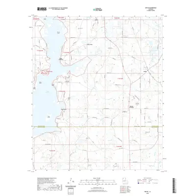
2020 Map of Heflin
USGS Topo · Published 2020About this map
Lake Bistineau dominates the western landscape of this Louisiana survey, punctuated by a series of named islands including Crane Island, Nancys Island, and Snake Island. The terrain is defined by a complex network of waterways such as Toulon Bayou, Brushy Cr, and Cooley Cr that feed into the lake. Settlement patterns are concentrated around the eastern corridors, where Heflin and Martin Junction serve as local hubs. This area is particularly rich in family-named landmarks and rural burial grounds, ranging from King Solomon Church Cem in the north to Theus Cem and Tomlinson Cem in the south.
Find a feature on this map
109 named features on this map. Tap any name to fly to it.
Don’t see what you’re looking for? This feature index may not catch every label — zoom into the map to look around manually.
Map Details
Editions of this 2020 Heflin Map
This is the sole edition of this map. No revisions or reprints were ever made.
Other maps of this area

1941 · Bossier Point
USGS Topo · 1:31,680

1947 · Ringgold
USGS Topo · 1:62,500

1947 · Minden
USGS Topo · 1:62,500

1948 · Jamestown
USGS Topo · 1:62,500

1949 · Jamestown
USGS Topo · 1:62,500

1949 · Minden
USGS Topo · 1:62,500

1949 · Gibsland
USGS Topo · 1:62,500

1950 · Gibsland
USGS Topo · 1:62,500

1955 · Shreveport
USGS Topo · 1:250,000

1956 · Shreveport
USGS Topo · 1:250,000