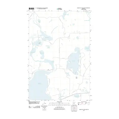
2010 Map of Height of Land Lake
USGS Topo · Published 2010About this map
The Otter Tail River winds through this glacial landscape, connecting a network of large water bodies including Chippewa Lake and Rice Lake. The 2010 geography reveals an engineered watershed where human infrastructure interacts with the natural flowage, evidenced by the Chippewa Dam, Rice Lake Dam, and the Gary Lehman Dam. These structures suggest a history of water level management for the region's expansive lakes. To the south, Height of Land Lake dominates the terrain, surrounded by a rural grid of roads like E Height of Land Dr and Lyman Lakes Rd. This map documents a quiet, water-rich portion of the county where seasonal residences and local travel routes like County Hwy-37 and E Island Lake Rd define the modern settlement pattern.
Find a feature on this map
33 named features on this map. Tap any name to fly to it.
Don’t see what you’re looking for? This feature index may not catch every label — zoom into the map to look around manually.
Map Details
Editions of this 2010 Height of Land Lake Map
This is the sole edition of this map. No revisions or reprints were ever made.
Other maps of this area

1953 · Brainerd
USGS Topo · 1:250,000

1954 · Bemidji
USGS Topo · 1:250,000

1957 · Brainerd
USGS Topo · 1:250,000

1957 · Bemidji
USGS Topo · 1:250,000

1958 · Bemidji
USGS Topo · 1:250,000

1958 · Brainerd
USGS Topo · 1:250,000

1959 · Toad Mountain
USGS Topo · 1:24,000

1959 · Flat Lake
USGS Topo · 1:24,000

1959 · Rochert
USGS Topo · 1:24,000

1959 · Height Of Land Lake
USGS Topo · 1:24,000