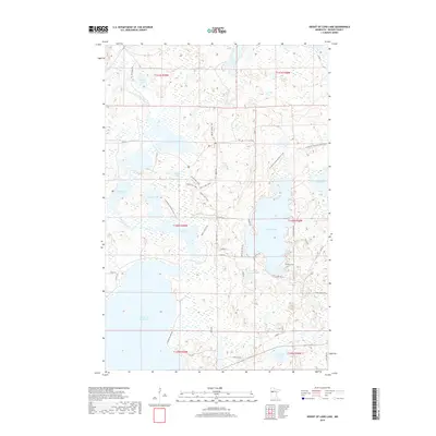
2019 Map of Height of Land Lake
USGS Topo · Published 2019About this map
Height of Land Lake dominates the southern landscape of this Becker County region, forming part of a complex lacustrine system connected by the Otter Tail River and the Egg River. The area is characterized by an intricate network of water bodies, including the centrally located Rice Lake and Island Lake, which are separated by narrow peninsulas and glacial landforms. The modern recreational and conservation footprint is evident through the path of the N Country National Scenic Trail, which winds past Johnson Lake and Booth Lake toward the eastern boundary near Mud Lake. Local infrastructure is defined by legacy routes such as Chippewa Trl and Schoolhouse Rd, reflecting a landscape transitioned from early settlement patterns to one of managed natural spaces and seasonal residences.
Find a feature on this map
41 named features on this map. Tap any name to fly to it.
Don’t see what you’re looking for? This feature index may not catch every label — zoom into the map to look around manually.
Map Details
Editions of this 2019 Height of Land Lake Map
This is the sole edition of this map. No revisions or reprints were ever made.
Other maps of this area

1953 · Brainerd
USGS Topo · 1:250,000

1954 · Bemidji
USGS Topo · 1:250,000

1957 · Brainerd
USGS Topo · 1:250,000

1957 · Bemidji
USGS Topo · 1:250,000

1958 · Bemidji
USGS Topo · 1:250,000

1958 · Brainerd
USGS Topo · 1:250,000

1959 · Toad Mountain
USGS Topo · 1:24,000

1959 · Flat Lake
USGS Topo · 1:24,000

1959 · Rochert
USGS Topo · 1:24,000

1959 · Height Of Land Lake
USGS Topo · 1:24,000