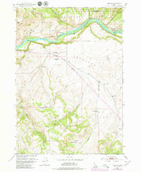
1951 Map of Heise SE
USGS Topo · Published 1979About this map
The Snake River carves a dramatic path through this high-country landscape, marking the boundary between Madison Co and Bonneville Co. The terrain is defined by the elevation gain from the alluvial Antelope Flat up toward the summits of Kelly Mountain and Table Rock. A distinct pattern of mid-century ranching is evident throughout the drainage basins of Antelope Creek and Little Pine Creek. Isolated homesteads like the Spaulding Ranch, Reed Ranch, and Wheeler Ranch are scattered across the foothills, while the presence of the Antelope Sch (Aban'd) suggests the historical consolidation of a once-active rural school district. Much of the northern terrain is preserved within the Targhee National Forest, where steep canyons like Spring Canyon descend toward the river's edge.
Find a feature on this map
24 named features on this map. Tap any name to fly to it.
Don’t see what you’re looking for? This feature index may not catch every label — zoom into the map to look around manually.
Map Details
Editions of this 1951 Heise SE Map
4 editions found
Other maps of this area

1924 · Hell Creek
USGS Topo · 1:62,500

1926 · Hell Creek
USGS Topo · 1:62,500

1932 · Irwin
USGS Topo · 1:96,000

1935 · Irwin
USGS Topo · 1:125,000

1943 · Garns Mtn
USGS Topo · 1:62,500

1946 · Garns Mtn
USGS Topo · 1:62,500

1951 · Poplar
USGS Topo · 1:24,000

1951 · Hawley Gulch
USGS Topo · 1:24,000

1951 · Heise
USGS Topo · 1:24,000

1951 · Heise SE
USGS Topo · 1:24,000