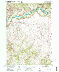
1951 Map of Heise SE
USGS Topo · Published 1979About this map
The Snake River carves through the northern portion of this landscape, separating the high elevations of Kelly Mountain and Table Rock from the broad expanse of Antelope to the south. This 1951 survey, updated with purple photorevisions from the late 1970s, captures a transition in rural land use within the Targhee National Forest and surrounding areas of Madison and Bonneville counties.
Find a feature on this map
27 named features on this map. Tap any name to fly to it.
Don’t see what you’re looking for? This feature index may not catch every label — zoom into the map to look around manually.
Map Details
Editions of this 1951 Heise SE Map
4 editions found
Other maps of this area

1924 · Hell Creek
USGS Topo · 1:62,500

1926 · Hell Creek
USGS Topo · 1:62,500

1932 · Irwin
USGS Topo · 1:96,000

1935 · Irwin
USGS Topo · 1:125,000

1943 · Garns Mtn
USGS Topo · 1:62,500

1946 · Garns Mtn
USGS Topo · 1:62,500

1951 · Poplar
USGS Topo · 1:24,000

1951 · Hawley Gulch
USGS Topo · 1:24,000

1951 · Heise
USGS Topo · 1:24,000

1951 · Heise SE
USGS Topo · 1:24,000