
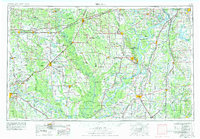
1955 Map of Helena
USGS Topo · Published 1967About this map
The Mississippi River and White River define this mid-century landscape of the Arkansas Delta and northwestern Mississippi. In the years following World War II, this region remained heavily reliant on its river-and-rail infrastructure, with major trunk lines like the Chicago Rock Island and Pacific RR and St Louis Southwestern RR connecting agricultural hubs like Stuttgart and Helena. Large-scale conservation efforts are prominent, including the White River National Wildlife Refuge and the St Francis National Forest, which preserve the bottomland hardwood character of the basin.
Find a feature on this map
113 named features on this map. Tap any name to fly to it.
Don’t see what you’re looking for? This feature index may not catch every label — zoom into the map to look around manually.
Map Details
Editions of this 1955 Helena Map
2 editions found
Other maps of this area

1891 · Little Rock
USGS Topo · 1:125,000

1893 · Little Rock
USGS Topo · 1:125,000

1908 · Lula
USGS Topo · 1:24,000

1908 · Dundee
USGS Topo · 1:24,000

1908 · Hollywood
USGS Topo · 1:24,000

1908 · Coahoma
USGS Topo · 1:24,000

1908 · Moon Lake
USGS Topo · 1:24,000

1908 · Jonestown
USGS Topo · 1:24,000

1908 · Walnut Lake
USGS Topo · 1:24,000

1908 · Lake Cormorant
USGS Topo · 1:24,000