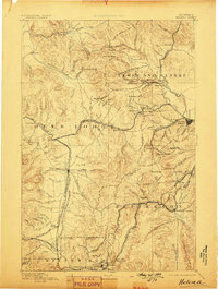
1893 Map of Helena
USGS Topo · Published 1899About this map
Helena and the copper-rich camps of Butte anchor this late-19th-century reconnaissance of the Continental Divide. The landscape is a complex network of mining districts and transit corridors, where the Northern Pacific Railroad and Montana Central Railroad navigate the steep grades of Mullan Pass and Elk Park Pass. Early mining centers such as Marysville, Blackfoot City, and Rimini appear alongside Last Chance Gulch, illustrating the era's rapid industrial expansion.
Find a feature on this map
142 named features on this map. Tap any name to fly to it.
Don’t see what you’re looking for? This feature index may not catch every label — zoom into the map to look around manually.
Map Details
Editions of this 1893 Helena Map
2 editions found
Other maps of this area

1886 · Great Falls
USGS Topo · 1:250,000

1886 · Fort Logan
USGS Topo · 1:250,000

1888 · Three Forks
USGS Topo · 1:250,000

1889 · Helena
USGS Topo · 1:250,000

1893 · Helena
USGS Topo · 1:250,000

1893 · Dillon
USGS Topo · 1:250,000

1894 · Three Forks
USGS Topo · 1:250,000

1895 · Three Forks
USGS Topo · 1:250,000

1899 · Boulder
USGS Topo · 1:125,000

1899 · Helena
USGS Topo · 1:62,500