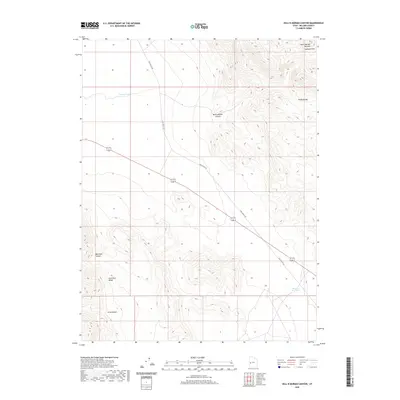
2020 Map of Hell'n Moriah Canyon
USGS Topo · Published 2020About this map
Hell'n Moriah Canyon cuts through the high desert of Millard County, defining a landscape shaped by the dramatic elevations of the House Range and the Confusion Range. This 2020 topographic survey illustrates the stark geomorphology of western Utah, where features like Sawtooth Mtn and the uniquely named Hell'n Moriah Kitchen dominate the northeast corner. Modern infrastructure is represented by the diagonal traverse of Tule Valley Rd, which serves as the primary artery through this arid basin. Water remains a scarce and critical resource, appearing only in isolated catchments such as Jackson Pond and Watsons Cou Pond. The map also details several secondary drainages, including Blackham Canyon and Arms Canyon, which provide essential geographic context for those studying the remote high-desert terrain and its sparse road network.
Find a feature on this map
10 named features on this map. Tap any name to fly to it.
Don’t see what you’re looking for? This feature index may not catch every label — zoom into the map to look around manually.
Map Details
Editions of this 2020 Hell'n Moriah Canyon Map
This is the sole edition of this map. No revisions or reprints were ever made.
Other maps of this area

1908 · Fish Springs
USGS Topo · 1:250,000

1910 · Fish Springs
USGS Topo · 1:250,000

1953 · Richfield
USGS Topo · 1:250,000

1953 · Delta
USGS Topo · 1:250,000

1958 · Richfield
USGS Topo · 1:250,000

1958 · Delta
USGS Topo · 1:250,000

1960 · Notch Peak
USGS Topo · 1:62,500

1960 · Crystal Peak
USGS Topo · 1:62,500

1960 · Conger Mountain
USGS Topo · 1:62,500

1960 · The Barn
USGS Topo · 1:62,500