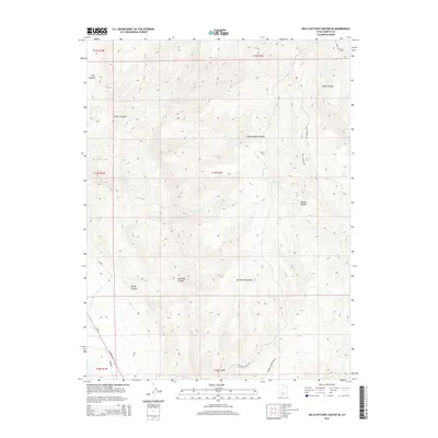
2014 Map of Hells Kitchen Canyon SE
USGS Topo · Published 2014About this map
The San Pitch Mountains dominate this high-desert landscape in central Utah, defined by a complex network of drainage systems and rugged elevation changes. Large geographic features such as Hells Kitchen Canyon, Maple Canyon, and Mellor Canyon carve through the terrain, illustrating the natural erosion patterns typical of the region. The map reveals a land utilized primarily for transit and resource access, with routes like Main Canyon Rd, Mellor Canyon Rd, and S Skyline W Mountain Rd winding through the high country. At the lower western elevations, Ut 28 provides the primary north-south artery. Water is scarce on the surface, represented only by the intermittent Dry Fork, which underscores the arid character of the canyons. Smaller features like Axhandle Canyon and Rough Canyon add to the intricate local topography of these Sanpete County uplands.
Find a feature on this map
23 named features on this map. Tap any name to fly to it.
Don’t see what you’re looking for? This feature index may not catch every label — zoom into the map to look around manually.
Map Details
Editions of this 2014 Hells Kitchen Canyon SE Map
This is the sole edition of this map. No revisions or reprints were ever made.
Other maps of this area
1885 · Manti
USGS Topo · 1:250,000
1895 · Manti
USGS Topo · 1:250,000
1956 · Price
USGS Topo · 1:250,000
1960 · Price
USGS Topo · 1:250,000
1962 · Price
USGS Topo · 1:250,000
1965 · Hells Kitchen Canyon SW
USGS Topo · 1:24,000
1965 · Chriss Canyon
USGS Topo · 1:24,000
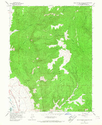
1965 · Hells Kitchen Canyon SE
USGS Topo · 1:24,000
1965 · Skinner Peaks
USGS Topo · 1:24,000
1965 · Manti
USGS Topo · 1:24,000