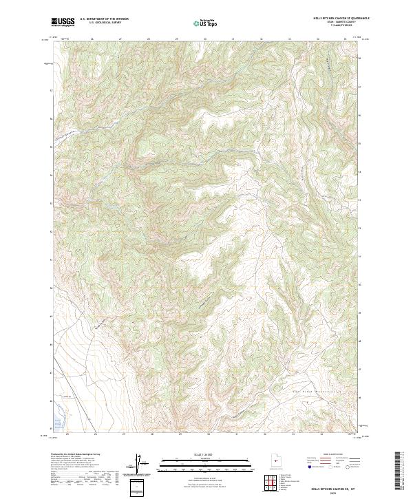
2023 Map of Hells Kitchen Canyon SE
USGS Topo · Published 2023About this map
The San Pitch Mountains dominate this topography, where a complex network of drainages defines the high desert landscape. Water management infrastructure is evident in the southwest corner, where the Gunnison Fayette Canal flows near the edge of the Sevier Bridge Reservoir, indicating the vital role of irrigation in this arid region. The map reveals a land sculpted by seasonal runoff, with prominent features such as Hells Kitchen Canyon, Axhandle Canyon, and Maple Canyon carving through the mountain range. Human presence is largely represented by access routes like Hell's Kitchen Rd and Bown Rd, which navigate the base of the ridges and the mouths of the canyons, providing essential paths for land management and recreation in the backcountry of Sanpete County.
Find a feature on this map
13 named features on this map. Tap any name to fly to it.
Don’t see what you’re looking for? This feature index may not catch every label — zoom into the map to look around manually.
Map Details
Editions of this 2023 Hells Kitchen Canyon SE Map
This is the sole edition of this map. No revisions or reprints were ever made.
Other maps of this area

1885 · Manti
USGS Topo · 1:250,000

1895 · Manti
USGS Topo · 1:250,000

1956 · Price
USGS Topo · 1:250,000

1960 · Price
USGS Topo · 1:250,000

1962 · Price
USGS Topo · 1:250,000
1965 · Hells Kitchen Canyon SW
USGS Topo · 1:24,000

1965 · Chriss Canyon
USGS Topo · 1:24,000

1965 · Hells Kitchen Canyon SE
USGS Topo · 1:24,000
1965 · Skinner Peaks
USGS Topo · 1:24,000

1965 · Manti
USGS Topo · 1:24,000