
1925 Map of Helm
USGS Topo · Published 1925About this map
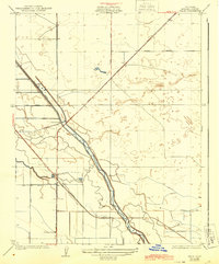
Fresno Slough dominates this central California landscape, reflecting a period of significant hydraulic engineering and agricultural development. The map illustrates a complex water management system characterized by the Stinson Canal, a Diversion Dam, and the Main Bypass, which together transformed the arid valley floor into productive farmland. Settled life centers on the rail-stop at Helm, where the Southern Pacific railroad line intersects with the local road network. The presence of the New Hope School and the settlement of Nares further south suggest the growing community of the mid-1920s. The landscape is defined by the rigid geometry of the public land survey system, with roads like Manning Avenue and Floral Avenue following section lines across the valley, creating a stark contrast with the meandering path of the slough.
Find a feature on this map
15 named features on this map. Tap any name to fly to it.
Don’t see what you’re looking for? This feature index may not catch every label — zoom into the map to look around manually.
Map Details
Editions of this 1925 Helm Map
2 editions found
Other maps of this area

1912 · Coalinga
USGS Topo · 1:125,000

1923 · Kearney Park
USGS Topo · 1:31,680

1924 · Jamesan
USGS Topo · 1:31,680

1925 · San Joaquin
USGS Topo · 1:31,680

1925 · Raisin
USGS Topo · 1:31,680

1927 · Burrel
USGS Topo · 1:31,680

1931 · Wheatville
USGS Topo · 1:31,680

1931 · Towne Oil Station
USGS Topo · 1:31,680
1946 · Kearney Park
USGS Topo · 1:24,000
1947 · San Joaquin
USGS Topo · 1:24,000